- Level Foundation
- Duration 56 hours
- Course by University of California, Davis
-
Offered by

About
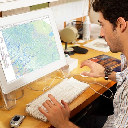
Explore the world of spatial analysis and cartography with geographic information systems (GIS). In this class you will learn the basics of the industry's leading software tool, ArcGIS, during four week-long modules: Week 1: Learn how GIS grew from paper maps to the globally integrated electronic software packages of today. You will install ArcGIS on your computer and learn how to use online help to answer technical questions. Week 2: Open up ArcGIS and explore data using ArcMap. Learn the foundational concepts of GIS, how to analyze data, and make your first map. Week 3: Make your own maps! Symbolize data and create an eye-catching final product. Week 4: Share your data and maps and learn to store and organize your data. Take Fundamentals of GIS as a standalone course or as part of the Geographic Information Systems (GIS) Specialization. By completing the first class in the Specialization you will gain the skills needed to succeed in the full program. Students who need an ArcGIS license will receive a non-commercial, 1 year student license for participation in this course and specialization.Modules
Course Overview
2
Videos
- Course Overview
- Course Mechanics
What is GIS?
1
Assignment
- Lesson 1 Quiz
1
Discussions
- Summarize this Lesson (What is GIS?)
7
Videos
- Module 1 Overview
- Why GIS is Awesome
- What is GIS?
- A First Look at Using Desktop GIS
- GIS Terminology to Know
- Tour of ArcGIS Pro
- Data Representation in GIS
1
Readings
- Glossary of Terms
Getting Started with GIS
1
Assignment
- Lesson 2 Quiz
1
External Tool
- Getting your copy of ArcGIS Desktop
1
Discussions
- Summarize this Lesson (Getting Started with GIS)
5
Videos
- Desktop GIS Software Packages
- Getting Help with GIS
- Relevant Skills for the GIS Analyst
- How Assignments Work in this Course
- Module 1 Summary
3
Readings
- Resources and Help for GIS
- ArcGIS Pro Installation
- Assignment 1: Introduction to ArcGIS Pro (Part 1)
Exploring Data
1
Assignment
- Lesson 3 Quiz
1
Discussions
- Summarize this Lesson (Exploring Data)
6
Videos
- Module 2 Overview
- Following Along
- Using ArcGIS Pro to Explore Data
- Viewing and Changing Layer Properties
- Using Feature Classes and Attribute Tables
- Selections
Projections and Geoprocessing
1
Assignment
- Lesson 4 Quiz
2
Discussions
- Spatial Joins
- Summarize this Lesson (Projections and Geoprocessing)
4
Videos
- An Introduction to Projections
- Geoprocessing, Environment Settings, and Spatial Joins
- Assignment 2 Overview
- Module 2 Summary
1
Readings
- Assignment 2: Introduction to ArcMap (Part 2)
Making Basic Maps
1
Assignment
- Lesson 5 Quiz
1
Discussions
- Summarize this Lesson (Making Basic Maps)
6
Videos
- Module 3 Overview
- Finding Common Datasets
- Using Layout View to Make Maps
- Using Map Elements
- Symbology: Changing How Your Data Looks
- Symbology Examples
Symbology, Labeling, and Map Books
1
Assignment
- Lesson 6 Quiz
1
Discussions
- Summarize this Lesson (Symbology, Labeling, and Map Books)
5
Videos
- Setting Up Symbology in ArcGIS Pro
- Labeling Map Features
- Making Map Books
- Assignment 3 Overview
- Module 3 Summary
1
Readings
- Assignment 3: Laying Out and Exporting Maps
Metadata and Sharing Data
1
Assignment
- Lesson 7 Quiz
1
Discussions
- Summarize this Lesson (Metadata and Sharing Data)
4
Videos
- Module 4 Overview
- Using Metadata to Document Data Products
- Creating and Uploading Packages with ArcGIS Pro
- Importing Map Packages
Data Storage, Table Joins, and Troubleshooting
1
Assignment
- Lesson 8 Quiz
1
Discussions
- Summarize this Lesson (Data Storage, Table Joins, and Troubleshooting)
4
Videos
- Choosing a Data Format
- Joins and Relates
- Troubleshooting ArcGIS Pro
- Module 4 Summary
Assignment: Wildfire Impacted Areas
1
Assignment
- Coursera and UC Davis Honor Code Acknowledgement
1
Peer Review
- Assignment 4: Wildfire Impacted Areas (Peer Review - Required)
1
Discussions
- Discussion: Wildfire Impacted Areas Follow-Up
1
Videos
- Assignment 4 (Peer Review) Overview
1
Readings
- Area Impacted by Wildfire Assignment Instructions
Course Summary
1
Videos
- Course Summary
2
Readings
- Before you Go, Join a Community!
- Acknowledgements
Auto Summary
Unlock the world of spatial analysis with "Fundamentals of GIS." In this four-week course, you'll master ArcGIS, the leading GIS software, through hands-on modules covering its history, data exploration, map creation, and data sharing. Ideal for beginners in Science & Engineering, this foundational course offers a non-commercial, 1-year ArcGIS license. Available on Coursera with multiple subscription options.

Nick Santos

Eric Howard


