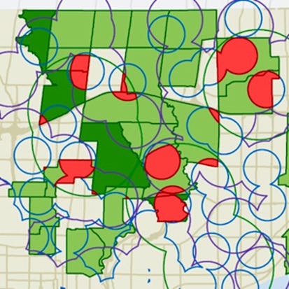
GIS, Mapping, and Spatial Analysis Capstone
In this capstone course, you will apply everything you have learned by designing and then completing your own GIS project. You will plan out your project by writing a brief proposal that explains what you plan to do and why. You will then find data for a topic and location of your choice, and perform analysis and create maps that allow you to try out different tools and data sets. The results of your work will be assembled into an Esri story map, which is a web site with maps, images, text, and video.
Buy Now AED 170.99 + VAT
Monthly Subscription Starting at AED 99 + VAT
- Level Foundation
- Duration 11 hours
- Course by University of Toronto
-
Offered by

About
In this capstone course, you will apply everything you have learned by designing and then completing your own GIS project. You will plan out your project by writing a brief proposal that explains what you plan to do and why. You will then find data for a topic and location of your choice, and perform analysis and create maps that allow you to try out different tools and data sets. The results of your work will be assembled into an Esri story map, which is a web site with maps, images, text, and video. The goal is for you to have a finished product that you can share, and that demonstrates what you have learned. Note: software is not provided for this course.Modules
Welcome to the Capstone Project!
-
 1
Videos
1
Videos
-
 1
Assignment
1
Assignment
![]() 1
Assignment
1
Assignment
- GIS Software needed for this course
![]() 1
Videos
1
Videos
- Introduction to the capstone project
Getting Started With Story Maps
-
3
Videos
-
1
Assignment
![]() 1
Assignment
1
Assignment
- Week 1 Quiz
![]() 3
Videos
3
Videos
- Introduction to story maps
- Building your first story map
- Adding pop-ups to a story map
Activity
-
 1
Readings
1
Readings
![]() 1
Readings
1
Readings
- Get started on your story map now
Developing your ideas, finding data sources, and writing your proposal
-
1
Readings
-
 1
PeerReview
1
PeerReview
![]() 1
Peer Review
1
Peer Review
- Proposal
![]() 1
Readings
1
Readings
- Advice and guidelines for writing your proposal
Review from the course "GIS Data Acquisition and Map Design"
-
8
Videos
![]() 8
Videos
8
Videos
- Evaluating data using metadata
- Data dictionary
- The importance of metadata
- Viewing and editing metadata in ArcMap
- Downloading and using GIS data
- Adding x,y data from a table
- Clipping a feature class
- Merging feature classes
Review from the course "Spatial Analysis and Satellite Imagery in a GIS"
-
7
Videos
![]() 7
Videos
7
Videos
- Interactive selection in ArcMap
- Select by attribute
- Queries and Venn diagrams
- Select by location
- Select by attribute and location in ArcMap
- Mixing attribute and location queries
- Reclassification and aggregation
Review from the course "GIS Data Acquisition and Map Design"
-
3
Videos
![]() 3
Videos
3
Videos
- Joining tables
- Working with tables in ArcMap
- Field calculations in tables
Vector review from the course "Spatial Analysis and Satellite Imagery in a GIS"
-
6
Videos
![]() 6
Videos
6
Videos
- Vector buffers
- Vector intersection and union
- Constraint analysis
- Areal interpolation
- Spatial join
- ArcToolbox introduction
Raster review from the course "Spatial Analysis and Satellite Imagery in a GIS"
-
8
Videos
![]() 8
Videos
8
Videos
- Raster zones and regions
- Raster mask and NoData cells
- Local raster operators
- Focal raster operators
- Zonal raster operators
- Global raster operators
- Raster weighted overlay
- Mosaic and aggregate tools
Geoprocessing review from the course "Spatial Analysis and Satellite Imagery in a GIS"
-
3
Videos
![]() 3
Videos
3
Videos
- What is geoprocessing?
- ModelBuilder example
- Getting started with ModelBuilder
Review from the course "Data Acquisition and Map Design"
-
12
Videos
![]() 12
Videos
12
Videos
- Design principles
- Visual hierarchy
- Contrast
- Figure-ground relationship
- Visual balance
- Choropleth maps
- Creating choropleth maps in ArcMap
- Data classification for mapping
- Data classification methods for mapping
- Dot maps
- Proportional symbol maps
- Graduated symbol maps
Overview
-
1
Readings
-
1
PeerReview
![]() 1
Peer Review
1
Peer Review
- Story Map
![]() 1
Readings
1
Readings
- Guidelines for your story map
Auto Summary
The GIS, Mapping, and Spatial Analysis Capstone, offered by Coursera, focuses on applying GIS knowledge through project design and execution. Learners will plan, source data, analyze, and create maps, culminating in an Esri story map. Ideal for foundational-level students in Science & Engineering, the course spans 660 minutes and offers various subscription options.

Don Boyes