


Generative AI for Business Leaders
Advertising with Meta
How Google does Machine Learning


Our Courses
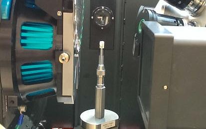
Introduction to advanced tomography
In this course you get the chance to get teaching and hands-on experience with the complete workflow of high-resolution tomography analysis. You will get introduced to data acquisition, 3D reconstruction, segmentation and meshing and, finally, 3D modelling of data to extract physical parameters describing mechanical and flow properties. The teaching and the exercises will take place in close interaction with top experts in the field. Exercises will require some basic programming skills, and will be carried out in a common python environment.
-
Course by

-
 Self Paced
-
 30 hours
-
 English

Data Manipulation at Scale: Systems and Algorithms
Data analysis has replaced data acquisition as the bottleneck to evidence-based decision making --- we are drowning in it. Extracting knowledge from large, heterogeneous, and noisy datasets requires not only powerful computing resources, but the programming abstractions to use them effectively.
-
Course by
-
Self Paced
-
20 hours
-
English

Internet of Things: Sensing and Actuation From Devices
Have you wondered how information from physical devices in the real world gets communicated to Smartphone processors? Do you want to make informed design decisions about sampling frequencies and bit-width requirements for various kinds of sensors? Do you want to gain expertise to affect the real world with actuators such as stepper motors, LEDs and generate notifications? In this course, you will learn to interface common sensors and actuators to the DragonBoard™ 410c hardware. You will then develop software to acquire sensory data, process the data and actuate stepper motors, LEDs, etc.
-
Course by
-
Self Paced
-
16 hours
-
English

Geographical Information Systems - Part 2
This course is the second part of a course dedicated to the theoretical and practical bases of Geographic Information Systems (GIS). It offers an introduction to GIS that does not require prior computer skills. It gives the opportunity to quickly acquire the basics that allow you to create spatial databases and produce geographic maps. This is a practical course that relies on the use of free Open Source software (QGIS, Geoda). In the first part of the course (Geographical Information Systems - Part 1), you explored the basics of land digitization and geodata storage.
-
Course by
-
Self Paced
-
10 hours
-
English

MRI Fundamentals
Welcome! In this course learners will develop expertise in basic magnetic resonance imaging (MRI) physics and principles and gain knowledge of many different data acquisition strategies in MRI. In particular, learners will get to know what is magnetic resonance phenomenon, how magnetic resonance signals are generated, how an image can be formulated using MRI, how soft tissue contrast can change with imaging parameters. Also introduced will be MR imaging sequences of spin echo, gradient echo, fast spin echo, echo planar imaging, inversion recovery, etc.
-
Course by
-
Self Paced
-
8 hours
-
English
GIS Data Acquisition and Map Design
In this course, you will learn how to find GIS data for your own projects, and how to create a well-designed map that effectively communicates your message. The first section focuses on the basic building blocks of GIS data, so that you know what types of GIS files exist, and the implications of choosing one type over another. Next, we'll discuss metadata (which is information about a data set) so you know how to evaluate a data set before you decide to use it, as well as preparing data by merging and clipping files as needed.
-
Course by
-
Self Paced
-
20 hours
-
English