


Generative AI for Business Leaders
Advertising with Meta
How Google does Machine Learning


Our Courses
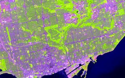
GIS, Mapping, and Spatial Analysis
This Specialization is for those new to mapping and GIS, as well as anyone looking to gain a better understanding of how it all works and why. You will learn practical skills that can be applied to your own work using cutting-edge software created by Esri Inc., the world's leading GIS company and our industry partner. PLEASE NOTE: THE SOFTWARE IS NO LONGER PROVIDED WITH THIS COURSE. YOU WILL HAVE TO OBTAIN IT ON YOUR OWN.
-
Course by

-
 Self Paced
-
 English
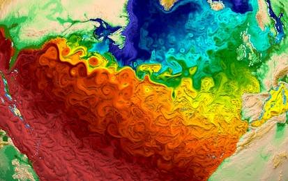
Climate Geospatial Analysis on Python with Xarray
By the end of this project, you will be able to load, visualize, manipulate and perform both simple and grouped operations over geospatial multidimensional data through Xarray and Python.
-
Course by
-
Self Paced
-
 4 hours
-
English

Geographical Information Systems - Part 2
This course is the second part of a course dedicated to the theoretical and practical bases of Geographic Information Systems (GIS). It offers an introduction to GIS that does not require prior computer skills. It gives the opportunity to quickly acquire the basics that allow you to create spatial databases and produce geographic maps. This is a practical course that relies on the use of free Open Source software (QGIS, Geoda). In the first part of the course (Geographical Information Systems - Part 1), you explored the basics of land digitization and geodata storage.
-
Course by
-
Self Paced
-
10 hours
-
English

Getting Started with Spatial Analysis in GeoDa
By the end of this project, learners will know how to start out with GeoDa to use it for spatial analyses.
-
Course by
-
Self Paced
-
2 hours
-
English

Geographical Information Systems - Part 1
This course is organized into two parts presenting the theoretical and practical foundations of geographic information systems (GIS). - Together theses courses constitute an introduction to GIS and require no prior knowledge. - By following this introduction to GIS you will quickly acquire the basic knowledge required to create spatial databases and produce high-quality maps and cartographic representations. - This is a practical course and is based on free, open-source software, including QGIS. If you study or work in the fields of land management or the analysis of geographically distributed
-
Course by
-
Self Paced
-
20 hours
-
English

Geospatial Analysis Project
In this project-based course, you will design and execute a complete GIS-based analysis – from identifying a concept, question or issue you wish to develop, all the way to final data products and maps that you can add to your portfolio. Your completed project will demonstrate your mastery of the content in the GIS Specialization and is broken up into four phases:
Milestone 1: Project Proposal - Conceptualize and design your project in the abstract, and write a short proposal that includes the project description, expected data needs, timeline, and how you expect to complete it.
-
Course by
-
Self Paced
-
62 hours
-
English
Geospatial and Environmental Analysis
Apply your GIS knowledge in this course on geospatial analysis, focusing on analysis tools, 3D data, working with rasters, projections, and environment variables. Through all four weeks of this course, we'll work throug…
-
Course by
-
Self Paced
-
English

Spatial Analysis and Satellite Imagery in a GIS
In this course, you will learn how to analyze map data using different data types and methods to answer geographic questions. First, you will learn how to filter a data set using different types of queries to find just the data you need to answer a particular question. Then, we will discuss simple yet powerful analysis methods that use vector data to find spatial relationships within and between data sets. In this section, you will also learn about how to use ModelBuilder, a simple but powerful tool for building analysis flowcharts that can then also be run as models.
-
Course by
-
Self Paced
-
14 hours
-
English
Introduction to GIS Mapping
Get started learning about the fascinating and useful world of geographic information systems (GIS)! In this first course of the specialization GIS, Mapping, and Spatial Analysis, you'll learn about what a GIS is, how to get started with the software yourself, how things we find in the real world can be represented on a map, how we record locations using coordinates, and how we can make a two-dimensional map from a three-dimensional Earth. In the course project, you will create your own GIS data by tracing geographic features from a satellite image for a location and theme of your choice.
-
Course by
-
Self Paced
-
14 hours
-
English
GIS, Mapping, and Spatial Analysis Capstone
In this capstone course, you will apply everything you have learned by designing and then completing your own GIS project. You will plan out your project by writing a brief proposal that explains what you plan to do and why. You will then find data for a topic and location of your choice, and perform analysis and create maps that allow you to try out different tools and data sets. The results of your work will be assembled into an Esri story map, which is a web site with maps, images, text, and video.
-
Course by
-
Self Paced
-
11 hours
-
English

Fundamentals of GIS
Explore the world of spatial analysis and cartography with geographic information systems (GIS). In this class you will learn the basics of the industry’s leading software tool, ArcGIS, during four week-long modules: Week 1: Learn how GIS grew from paper maps to the globally integrated electronic software packages of today. You will install ArcGIS on your computer and learn how to use online help to answer technical questions. Week 2: Open up ArcGIS and explore data using ArcMap.
-
Course by
-
Self Paced
-
56 hours
-
English